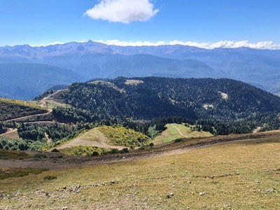
Rosa Khutor
Rosa Peak → Nakhazo
Difficulty: Moderate 3/5
mountainspanoramascable carout-and-back
Time5 h 02 min
Distance10.21 km
Max elevation2329 m
Ascent489 m
Descent489 m
About the route
From Rosa Peak the trail follows the southern side of the Aibga ridge toward the remote Nakhazo area. Open high-altitude terrain and wide panoramas dominate the first part, followed by more sheltered sections. For a one-day hike, return to Rosa Peak and keep a margin before the cable cars close.
FormatOut-and-back
StartRosa Peak
FinishReturn to the start point, Rosa Peak
Verified trackRoute geometry is based on a real local GPX track.